

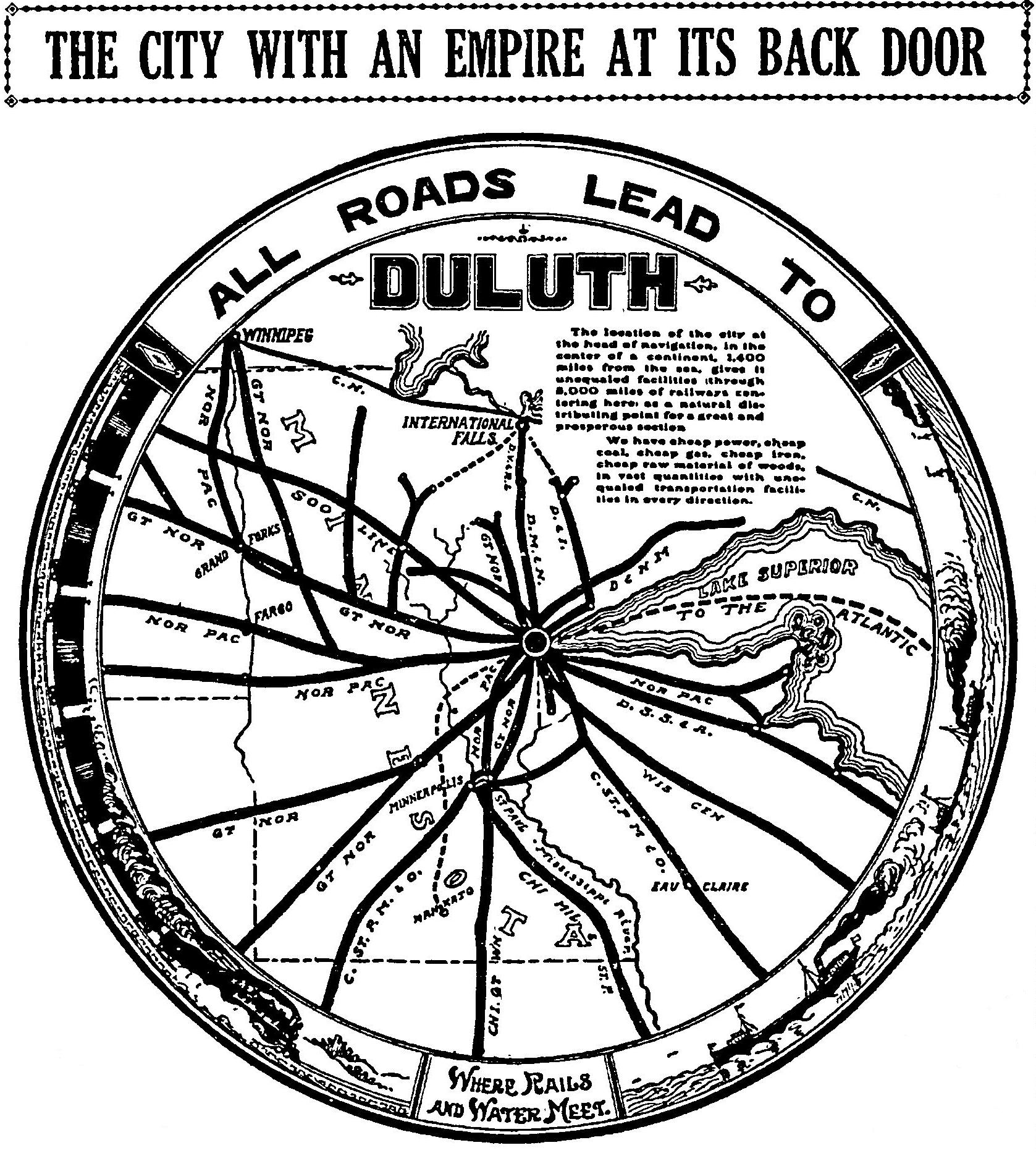
The location of the city at the head of navigation, in the center of a continent, 1,400 miles from the sea, gives it unequaled facilities (through 8,000 miles of railways centering here) as a natural distributing point for a great and prosperous section.
We have cheap power, cheap coal, cheap gas, cheap iron, cheap raw material of woods, in vast quantities with unequaled transportation facilities in every direction.
—Duluth News Tribune, Sept. 30, 1914
10 thoughts on “All roads lead to Duluth”
Wha happen?
What happened is winter. And that ol’ bastard comes back every year.
Also what happened is the discovery that it’s easy to exploit third-world countries for the resources, and a redefinition of the word “cheap.”
I’ll go out on a limb and predict that Duluth will become a boom town within 25 years for one reason: Proximity to large quantities of fresh water.
Rail shipping is just not utilized as it once was, unfortunately.
Duluth is a rail hub featured in the board game Ticket to Ride, a good game, if anyone is interested. The position of Duluth on the board is closer to the Twin cities though.
Well, it seems that if it had ended up being true, we’d be just that much closer to having that monstrosity of a NAFTA superhighway right where 53 goes now. I’m not sad we’re a backwater, no siree-bob.
That’s the worst map of Lake Superior I’ve ever seen. I could do a better job drunk on a bar napkin.
So who was the target audience for the “back door” and sphincter drawing combination?
This would make a great T-shirt. Someone get on that.
There’s a similar map that shows Duluth as the center of North America. It was originally published by the Gary Land Company that was attempting to attract investors. You can see it on page 60 of Alanen’s Morgan Park book.
JohnM, it seems like that sphincter has some serious anal fissures. We need a doctor!